Mountain Ranges
The Hindukush and Hinduraj mountain ranges
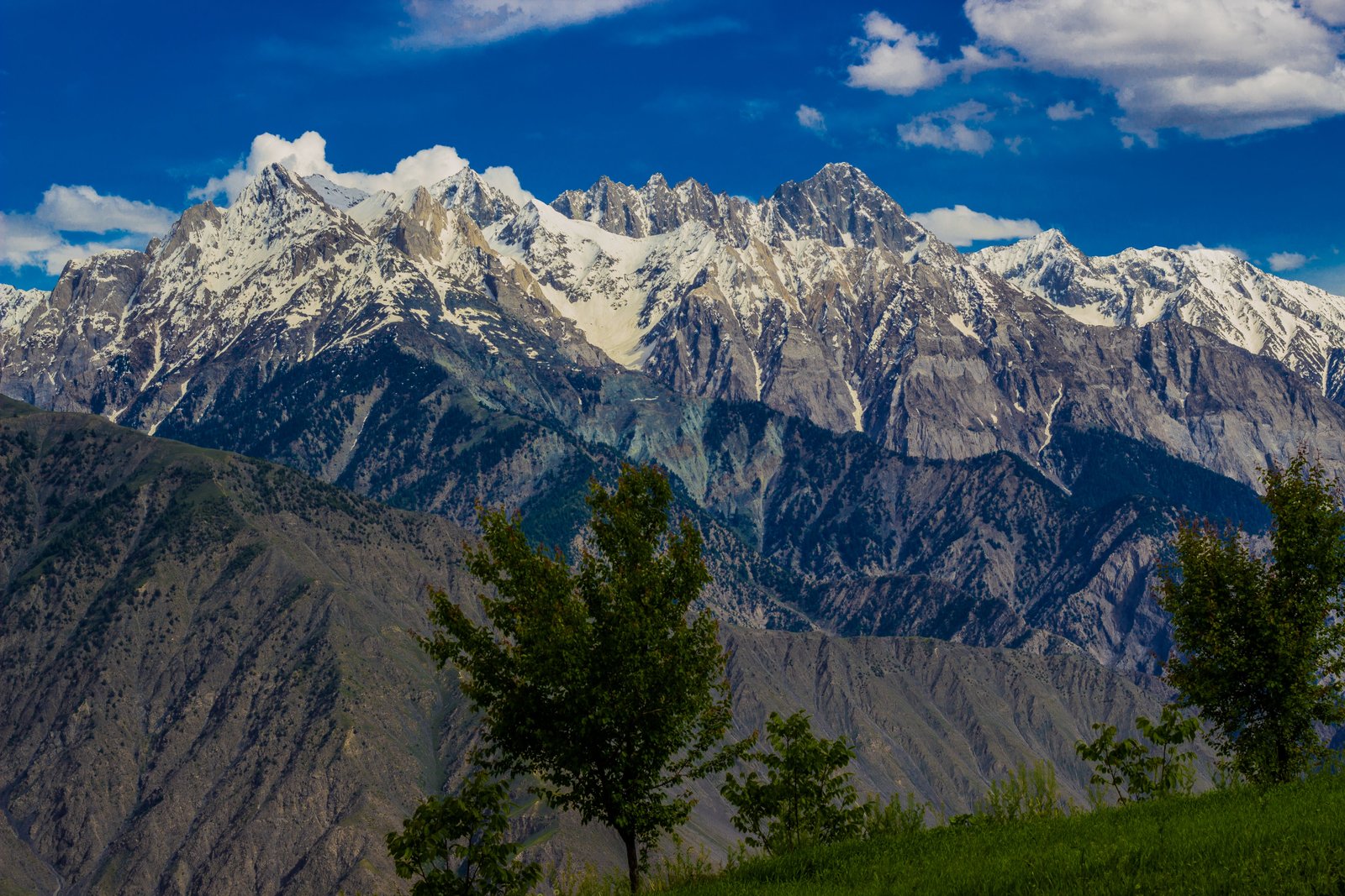
The Hindukush Mountains, like the Himalayas, are evolving before our very eyes. With over 200 peaks rising above 6,000 meters and several surpassing 7,000 meters—including the towering Tirich Mir at 7,708 meters—the range is continuously thrusting upward by 4 to 5 inches each year. However, these mountains are also subject to erosion at nearly the same rate, resulting in dramatic landscapes shaped by earthquakes, landslides, and floods. The region is a battleground where entire hillsides can collapse overnight, and fast-flowing rivers carve out new gorges amidst the massifs.
The Hindu Kush range forms the watershed between the valleys draining the Amu River—known as the Oxus—in the Pamirs, and the Indus River basin, which drains into the Arabian Sea. This extensive mountain range can be divided into three regions:
- Eastern Region: Extends from the Wakhjir Pass (4,907m) in the Little Pamir to the Dorah Pass (4,510m), spanning about 320 km along the China, Pakistan, and Afghanistan frontier.
- Second Region: Lies in Afghanistan beyond the Dorah Pass, featuring major peaks in Badakhshan and Nuristan.
- Third Region: Known as the Hindu Raj or the Thui Range, it is entirely within Pakistan, stretching 240 km along the Swat and Kohistan valleys.
In 328 B.C., Alexander the Great crossed this range, calling it "the mountains over which no eagles can fly." Here, he founded the garrison town "Alexandria-in-the-Caucasus." Many of his troops mistakenly believed they were crossing the Caucasus because of the similar legend of the eagle that gnawed at Prometheus's liver. Marco Polo later called it "the highest place in the world."
The Hindu Kush, as a mountain range, extends from the Wakhjir Pass at the junction of the Pamirs and Karakoram to the Khawak Pass (3,548m) north of Kabul. To the southwest, the mountains lose their glaciers and spread out into central Afghanistan.
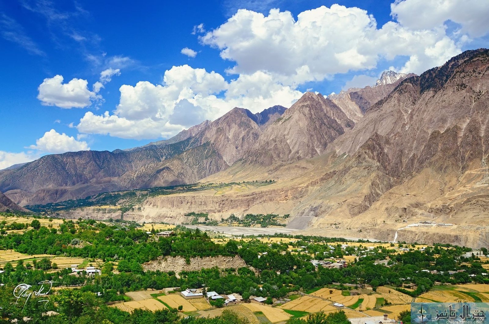
Chitral:
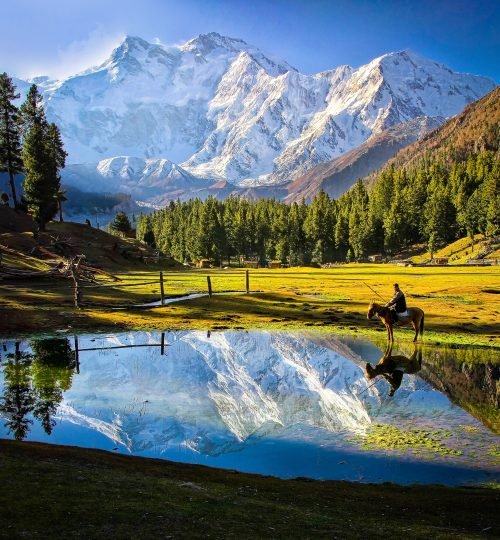
This remote and peaceful land of mountain valleys and rapid streams is located in the northwestern corner of Pakistan. Chitral, an ancient kingdom, covers an area of about 7,000 square miles and is surrounded by the snow-clad peaks of the Hindukush range, with Tirich Mir (7,708m) standing sentinel over the region.
Chitral has a rich history, having been a passage for waves of invaders, from the Aryans to Alexander the Great and Genghis Khan's hordes. The Kalash tribe, one of the remnants of these invasions, still resides here. Historically, the Chitral Valley was a key artery of the Silk Road, linking trade between Central Asia and the Indian subcontinent.
The area became significant in the "Great Game" between the Russian and British Empires, a period detailed in the works of Peter Hopkirk, Algernon Durand, and John Keays. Due to its unique geopolitical location, Chitral remains strategically important for future developments involving Afghanistan, Pakistan, Central Asia, and China. Despite its isolation, Chitral offers adventure-travelers unique experiences as the high passes leading to it are often snowbound for six months each year.
River Valleys & Agriculture:
The Chitral River originates in the Chiantar Glacier, flowing from an altitude of over 5,000 meters. It is known by different names throughout its course, including Yarkhun, Mastuj, and finally the Chitral River, before becoming the Kunar River in Afghanistan and re-entering Pakistan as the Kabul River. The river valley spans over 300 km, with the plain widening to over 4 km below Chitral town.
Agriculture in Chitral follows traditional methods, with wooden plows and sickles still in use. The main crops include barley, wheat, millet, rice, vegetables, and fruits, all grown through gravity-fed irrigation channels. Despite double cropping, the region relies on imported food grains due to an annual deficit. The Chitrali diet is simple, centered around dairy products and wheat. Unique local dishes include Khasta Shapik, Chapouti, and Shupinak—a thick, creamy cheese. Though rarely found in local hotels, these dishes can be experienced in private homes or at the "Home Stay at Ayun Fort," which offers traditional local cuisines to its guests.
The Karakorum and Himalayas
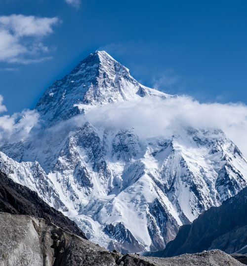
The Karakoram is the pinnacle of the mountain world, a breathtaking wilderness of rock, black ice, sheer cliffs, and foaming rivers. This range includes the mountains north of the lower Shyok, Indus, and lower Gilgit rivers, extending as far west as the Ishkoman and Karamber valleys. The name "Karakoram" means "black rock" in Turkic, which aptly describes the rugged mountains. No other range boasts such a concentration of mighty peaks: three of the six highest mountains in the world, five peaks over 8,000 meters, 29 peaks above 7,500 meters, and 60 summits over 6,700 meters. Among these is the earth’s second-highest mountain, K2 (8,611 meters), as well as the earth’s largest non-polar glacier, the Hispar-Biafo Glacier, which extends 76 miles (122 km) from source to moraine. This region features the greatest concentration of ice outside the Arctic and Antarctic and some of the most spectacular mountain scenery on the planet.
Most of these towering peaks are found in the 300 km long Great Karakoram range, which forms the main crest line of the system. This range is divided into sections: the Batura Muztagh, Hispar Muztagh, Panmah Muztagh, and Baltoro Muztagh, running eastward. The shorter ranges on either side of this great icebound crest are collectively known as the Lesser Karakoram range. On the northern side are the Lupgar and Ghuzherav mountains, while the southern side features the Naltar, Rakaposhi, Haramosh, Spantik-Sosbun, Mangom Gusor, Shimshal, Masherbrum, and Saltoro mountains.
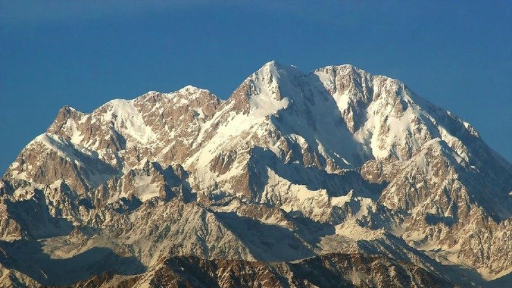
What is true of the Lesser Himalayas also applies to the Greater Trans-Himalayas, which stretch over 1,500 miles (2,414 km) from Nanga Parbat (8,126 meters) on the Indus River to Namcha Barwa (7,761 meters) on the Brahmaputra River. This region is home to giants whose names are known not only to mountaineers but to adventurers worldwide. It is a land of rare animals, the highest flowering plants, and the highest inhabited dwellings.
Northern Areas: River Valleys & Agriculture
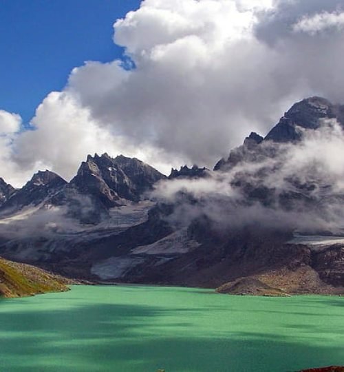
In western Tibet, two mighty rivers originate within a few miles of each other: the Brahmaputra, which flows east to Bhutan, and the Indus, which flows west through the Himalayas in a crescent, encircling the subcontinent through Tibet and Ladakh before entering Baltistan. These rivers link the cultures and people of different regions. Numerous tributaries rise and fall to form a unique landscape of mountain chains, gorges, and valleys with striking contrasts. Most parts of these mountains are arid and receive very little monsoon rain. The snow and glaciers from these mountains are the sources of an extensive network of rivers that cut deeply through the landscape. The Braldu, Shigar, Shyok, Shimshal, Hunza, Ishkuman, and Ghizar rivers all flow into the mighty Indus River, which, being older than the mountains themselves, is the only river to flow through the Karakoram range. The central and upper Ghizar rivers drain the Hindukush range and its offshoot, the Hindu Raj range. From the heavily glaciated Karakoram flow the Hunza and Shyok rivers, while Nanga Parbat’s glaciers feed into the Indus River, separating this Himalayan massif from the Karakoram.
Village life in this region is characterized by subsistence agriculture, where every bit of land is utilized in combination with animal husbandry. Corn, buckwheat, and millet are staple crops, while the lower valleys produce some rice and vegetables, with potatoes serving as a cash crop. Cultivation is supported by intensive irrigation through canals carved across sheer cliffs and scree slopes, which are engineering marvels. It is possible to grow two crops per year at elevations as high as 2,400 meters. Sheep and goats are raised in most areas, along with dairy cows. Bulls are used for plowing and threshing, yoked together and driven over harvested grain. At higher altitudes, yaks are the preferred livestock.